-


Follow Us

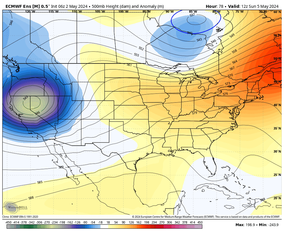
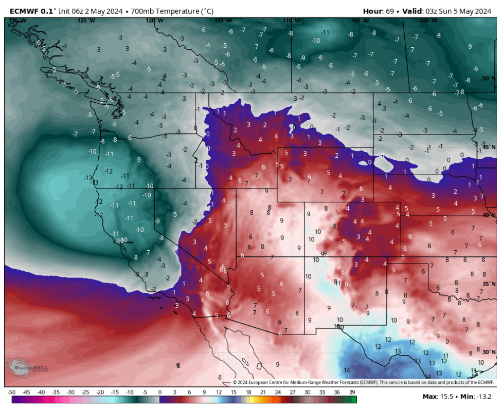
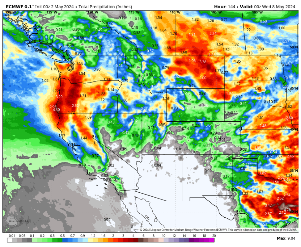
Powderchasers is watching a developing low over the Gulf of Alaska that will swing south over the Cascades, entering Oregon, Nevada, and California by Friday night-Saturday. The main focus for the Cascades will favor southern areas in Washington extending into Oregon. Peak snowfall for these areas will be on Saturday (Storm skiing) and extend into Sunday. Slightly lower totals are likely extending into central Washington (Stevens Pass) where it will also be snowing at pass level.
Crystal Mountain, Mt Hood Meadows, Timberline, and Mt Bachelor are spinning lifts this weekend. Storm totals could exceed 10-16 inches above 4000 feet by late Saturday. This will be an unusually cold storm for early May. Conditions remain unsettled into early next week with storm totals by Monday/Tuesday in the 12-22 inch range (Northern Oregon is favored).
The Sierra range will grab 9-12 inches above 7,000 feet peaking early Saturday to Sunday. Snow levels start high with strong winds Friday night and lower to lake level by Saturday night. We don't expect more than 3-4 inches at lake level Saturday/Sunday. Mountain passes will be snow-covered by midday Saturday with travel impacts likely Saturday night.
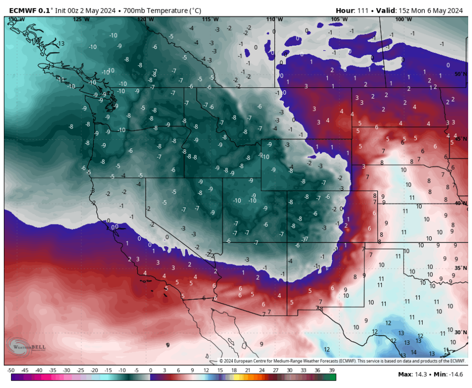
The action moves into Idaho on Sunday with western regions near McCall grabbing moderate snowfall, including the Panhandle on the Montana border.
Some big totals are likely for the Rockies peaking from Sunday to afternoon to Monday. The models are depicting a storm that we might normally see in February or March with cold temps and decent storm totals over a wide area of the Rockies. There is very high confidence in significant storm totals for the Tetons, and the Wasatch Range with moderate confidence of some big numbers landing in southern Montana through Monday. Northern Montana will also see some decent totals near Glacier National Park. Snow levels will be lowering late Sunday.
Please check to be sure your mountain is open before venturing out. Some have migrated to a weekend schedule which could play out well for this storm, while a few are still open 7 days a week.
You can follow Powderchasers on Instagram and FB @powderchasers
Forecaster @powderchasersteve (Instagram).
More must-reads:
- Cavaliers could be forced to choose between star guard pairing
- Caitlin Clark's debut was most-watched WNBA game in more than 20 years
- The 'Most career 40-point playoff games' quiz
Breaking News
Customize Your Newsletter
 +
+
Get the latest news and rumors, customized to your favorite sports and teams. Emailed daily. Always free!